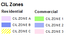
CIL Zones
- Residential Zone
- Commercial Zone
Metrogreen Area of Change
- Metrogreen Area of Change
Urban Core Boundary
- Urban Core Boundary
Local Plan Policies
Urban Core
- Primary Pedestrian Routes
- Secondary Pedestrian Routes
- Urban Core Distributor Routes
- Keelman's Way
- Development Opportunity
- Exemplar Neighbourhood
- Gateshead Quays
- Primary Retail Frontages
- Primary Shopping Areas
Economic Prosperity
- South of Follingsby Employment Site
- Employment Land Supply
- Key Employment Areas
- Main Employment Areas
- Local Employment Areas
- Tyne Marshalling Yard
- District Shopping Centre
- Local Shopping Centre

Homes
- Neighbourhood and Village Housing Site
- Housing Site Allocation
- Traveller Site
Transport and Accessibility
- Safeguarded Land for Transport Improvement
- A1 Road Improvements
- River Tyne Corridor
People and Place
- Green Belt Boundary
- Areas of Special Character
- River Tyne Gorge
- Conservation Areas
- Locally Listed Park/Garden
- Scheduled Ancient Monument
- Historic Parks & Gardens
- Scheduled Ancient Monument / Heritage at Risk
- Newburn Ford Battlefield
- Gateshead Flood Schemes
- Settlement Envelopes
- Proposed Wardley Manor Country Park
- SSSI
- Local Wildlife Sites
- Local Nature Reserves
- Wildlife Corridors
- Allotments
- Accessible Natural Greenspace
- Accessible Natural Greenspace which functions as Large Public Open Spaces
- Recreational Open Space
- Outdoor Sports
- Highfield School Site
- Key routeways
- Birtley Health Care Facility
- Opportunity Areas
- Strategic Green Infrastructure
- Landscape Sensitivity- Medium sensitivity
- Landscape Sensitivity - High / Very High
- Aerodrome Safeguarding: All Developments
- Aerodrome Safeguarding: All Developments likely to attract birds and all applications likely to affect aviation
- Aerodrome Safeguarding: All Buildings, Structures, Erections and Works Exceeding 10m in Height
- Aerodrome Safeguarding: All Buildings, Structures, Erections and Works Exceeding 15m in Height
- Aerodrome Safeguarding: All Buildings, Structures, Erections and Works Exceeding 45m in Height
- Aerodrome Safeguarding: All Buildings, Structures, Erections and Works Exceeding 90m in Height
Minerals & Waste
- Mineral Safeguarding Area
- Quarry Reclamation Sites
- Safeguarding mineral related infrastructure
- Lamesley Brick Clay Deposit
- OS base
- Aerials